Dusun Kemit Pada Google Map / Foto Satelit
May 15, 2008 by airianto
Filed under Geomatics Science, Remote Sensing

ALOS
May 3, 2008 by airianto
Filed under ALOS, Satellite Imagery

ALOS Satellite - www.jaxa.jp/projects/sat/
The Advanced Land Observing Satellite “DAICHI” (ALOS) has been developed to contribute to the fields of mapping, precise regional land coverage observation, disaster monitoring, and resource surveying. It enhances land observation technologies acquired through the development and operation of its predecessors, the Japanese Earth Resource Satellite-1 (JERS-1, or Fuyo) and the Advanced Earth Observing Satellite (ADEOS, or Midori). Read more
Constellation of Galileo Satellites
April 16, 2008 by airianto
Filed under GNSS, Galileo, Geomatics Science

Galileo Constellation
When Galileo, Europe’s own global satellite navigation system, is fully operational, there will be 30 satellites in Medium Earth Orbit (MEO) at an altitude of 23 222 kilometres. Ten satellites will occupy each of three orbital planes inclined at an angle of 56° to the equator. The satellites will be spread evenly around each plane and will take about 14 hours to orbit the Earth. One satellite in each plane will be a spare; on stand-by should any operational satellite fail.
GLONASS
April 1, 2008 by airianto
Filed under GLONASS, GNSS, Geomatics Science

Glonass
The Global Navigation Satellite System (GLONASS) is based on a constellation of active satellites which continuously transmit coded signals in two frequency bands, which can be received by users anywhere on the Earth’s surface to identify their position and velocity in real time based on ranging measurements.
The system is a counterpart to the United States Global Positioning System (GPS) and both systems share the same principles in the data transmission and positioning methods. GLONASS is managed for the Russian Federation Government by the Russian Space Forces and the system is operated by the Coordination Scientific Information Center (KNITs) of the Ministry of Defense of the Russian Federation.
Adam Technology
March 19, 2008 by airianto
Filed under Adam Technology, Geomatic Industry, Photogrammetry Tools
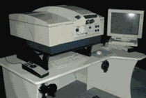
Promap Ortho System
ADAM Technology develop innovative precision measuring systems for the world of remote 3D measurement. ADAM manufacture specialist photogrammetric systems including the MPS-2 MicroPhotogrammetric Stereoplotter System, and the highly accurate, large format, PROMAP System stereoplotter, all using ADAM’s own suite of Software. ADAM is now involved in automatic 3 dimensional Dynamic Measurement technology – 3DM.
ADAM introduced the Analogue to Analytical stereoplotter conversion for the Wild B8, Kern PG-2 and the Zeiss Topocart allowing a cost-effective transition of these medium order instruments to high accuracy, PC based analytical stereoplotters. These conversions now cover the Wild BC series, and encoded solutions are available for the Wild A8 and A10 machines.