


GPS and Inertial Navigation
June 26, 2009 by airianto
Filed under GNSS, GPS, Geomatics Science

GPS/INS direct georeferencing
GPS aided inertial navigation systems have been available for commercial mapping applications for approximately a decade, pioneered by Canadian-based Applanix Corporation with their Read more

GPS
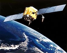
GPS Satellite
The Global Positioning System (GPS) is a space-based radio-navigation system consisting of a constellation of satellites and a network of ground stations used for monitoring and control. A minimum of 24 GPS satellites orbit the Earth at an altitude of approximately Read more
Low Latitude Troposphere: A Preliminary Study Using GPS CORS Data in South East Asia
January 1, 2009 by airianto
Filed under GPS, Geomatics Science
Hot and wet conditions in the equatorial or low latitude region degrade satellite positioning accuracy noticeably. The degradation is related to the strong tropospheric effect, especially the wet component which is approximately proportional to the content of water vapor in the troposphere and thus makes satellite positioning more challenging in this region.
Despite the efforts to achieve better understanding of the signal delay in the low latitude troposphere, much more still remains to be improved.


