GPS
May 25, 2009 by airianto
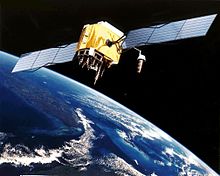
GPS Satellite
The Global Positioning System (GPS) is a space-based radio-navigation system consisting of a constellation of satellites and a network of ground stations used for monitoring and control. A minimum of 24 GPS satellites orbit the Earth at an altitude of approximately 11,000 miles providing users with accurate information on position, velocity, and time anywhere in the world and in all weather conditions.
GPS is operated and maintained by the Department of Defense (DoD). The National Space-Based Positioning, Navigation, and Timing (PNT) Executive Committee manages GPS, while the U.S. Coast Guard acts as the civil interface to the public for GPS matters. The Federal Aviation Administration is investigating and applying the use of GPS as it pertains to aviation.
History and Development

- GPS Constellation
The Global Positioning System, formally known as the Navstar Global Positioning System, was initiated in 1973 to reduce the proliferation of navigation aids. By creating a system that overcame the limitations of many existing navigation systems, GPS became attractive to a broad spectrum of users worldwide. The Global Positioning System has been successful in virtually all navigation applications, and because its capabilities are accessible using small, inexpensive equipment, GPS is being utilized in a wide variety of applications across the globe.
GPS – How It Works
Satellite Navigation is based on a global network of satellites that transmit radio signals in medium earth orbit. Users of Satellite Navigation are most familiar with the 24 Global Positioning System (GPS) satellites*. The United States, who developed and operates GPS, and Russia, who developed a similar system known as GLONASS, have offered free use of their respective systems to the international community. The International Civil Aviation Organization (ICAO), as well as other international user groups, have accepted GPS and GLONASS as the core for an international civil satellite navigation capability known as the Global Navigation Satellite System (GNSS).

- GPS Works
The basic GPS service provides users with approximately 100-meter accuracy, 95% of the time, anywhere on or near the surface of the earth. To accomplish this, each of the 24 satellites emits signals to receivers that determine their location by computing the difference between the time that a signal is sent and the time it is received. GPS satellites carry atomic clocks that provide extremely accurate time. The time information is placed in the codes broadcast by the satellite so that a receiver can continuously determine the time the signal was broadcast. The signal contains data that a receiver uses to compute the locations of the satellites and to make other adjustments needed for accurate positioning. The receiver uses the time difference between the time of signal reception and the broadcast time to compute the distance, or range, from the receiver to the satellite. The receiver must account for propagation delays, or decreases in the signal’s speed caused by the ionosphere and the troposphere. With information about the ranges to three satellites and the location of the satellite when the signal was sent, the receiver can compute its own three-dimensional position. An atomic clock synchronized to GPS is required in order to compute ranges from these three signals. However, by taking a measurement from a fourth satellite, the receiver avoids the need for an atomic clock. Thus, the receiver uses four satellites to compute latitude, longitude, altitude, and time.
The Control Segment of GPS consists of:
Master Control Station: The master control station, located at Falcon Air Force Base in Colorado Springs, Colorado, is responsible for overall management of the remote monitoring and transmission sites. GPS ephemeris being a tabulation of computed positions, velocities and derived right ascension and declination of GPS satellites at specific times, replace “position” with “ephemeris” because the Master Control Station computes not only position but also velocity, right ascension and declination parameters for eventual upload to GPS satellites.

- Control Station
Monitor Stations: Six monitor stations are located at Falcon Air Force Base in Colorado, Cape Canaveral, Florida, Hawaii, Ascension Island in the Atlantic Ocean, Diego Garcia Atoll in the Indian Ocean, and Kwajalein Island in the South Pacific Ocean. Each of the monitor stations checks the exact altitude, position, speed, and overall health of the orbiting satellites. The control segment uses measurements collected by the monitor stations to predict the behavior of each satellite’s orbit and clock. The prediction data is up-linked, or transmitted, to the satellites for transmission back to the users. The control segment also ensures that the GPS satellite orbits and clocks remain within acceptable limits. A station can track up to 11 satellites at a time. This “check-up” is performed twice a day, by each station, as the satellites complete their journeys around the earth. Noted variations, such as those caused by the gravity of the moon, sun and the pressure of solar radiation, are passed along to the master control station.
Ground Antennas: Ground antennas monitor and track the satellites from horizon to horizon. They also transmit correction information to individual satellites.
GPS – Space Segment
The space segment includes the satellites and the Delta rockets that launch the satellites from Cape Canaveral, in Florida. GPS satellites fly in circular orbits at an altitude of 10,900 nauticalmiles (20,200 km) and with a period of 12 hours. The orbits are tilted to the earth’s equator by 55 degrees to ensure coverage of polar regions. Powered by solar cells, the satellites continuously orient themselves to point their solar panels toward the sun and their antenna toward the earth. Each of the 24 satellites, positioned in 6 orbital planes, circles the earth twice a day.
The satellites are composed of:
Solar Panels. Each satellite is equipped with solar array panels. These panels capture energy from the sun, which provides power for the satellite throughout its life.
External components such as antennas. The exterior of the GPS satellite has a variety of antennas. The signals generated by the radio transmitter are sent to GPS receivers via the L-band antennas. Another component is the radio transmitter, which generates the signal. Each of the 24 satellites transmits it’s own unique code in the signal.

Space Control
GPS – User Segment – Aviation
Aviation
Satellite navigation is being widely used by aviators throughout the world to overcome many of the deficiencies in today’s air traffic infrastructure. With its accurate, continuous, all-weather, three (GPS only) and four (GPS with augmentations) dimensional coverage, satellite navigation offers an initial navigation service that satisfies many of the requirements of users worldwide. Unlike current ground-based equipment, satellite navigation permits accurate aircraft position determination anywhere on or near the surface of the earth.

- GPS for Aviation
More specifically, an aggressive exploitation of satellite navigation technologies provides substantial benefits to both the providers of such services in the region, as well as the individual and combined user communities. The implementation of this technology in a country or region provides the following benefits to aviation transportation:
- Enhanced safety of flight throughout the region
- Seamless navigation service based on a standardized navigation service and common avionics
- More efficient, optimized, flexible, and user-preferred route structures
- Increased system capacity
- Reduced separation minimums resulting in increased capacity and capabilities
- Significant savings from shortened flight times and reduced fuel consumption
- Reduced costs to each individual State while increasing overall benefits to individual States and the entire region
- Further economies from reduced maintenance and operation of unnecessary ground-based systems
- Improved ground and cockpit situational awareness
- Increased landing capacity for aircraft and helicopters
Additionally, the implementation of this technology adds a margin of safety to operations within the expected coverage area by providing four-dimensional positioning, as opposed to the two-dimensional positioning of traditional systems. This reduces accidents by providing a consistent navigation capability that does not change, regardless of location, replacing major portions of current ground-based navigation infrastructures, and simplifying avionics suites. It also offers a precision approach capability at any airport within that region. All aircraft equipped with certified GPS/WAAS receivers have the needed accuracy, integrity, and availability for them to use GPS as a primary navigation aid, and thus experience the benefits of seamless travel.
Arrival
Aircraft arriving at the terminal area use set instructions to lead them into the local area to begin their landing approach. The current Standard Terminal Arrival Routes (STARS) are based upon the placement of navigation aids, aircraft performance, and obstructions to flight. Through more accurate and continuous position information, GPS will offer more flexible routes, easing congestion, saving time and fuel, especially at high-density airports.
Departure
Aircraft departing from the terminal area must comply with set instructions that will lead them safely to their enroute departure point. The current standard instrument departures (SIDs) are based on factors such as navigational aids available, aircraft performance, and obstructions to flight. Because of its accurate and continuous location information, GPS will offer direct and flexible departure routed, ease congestion, and save time and fuel while maintaining high levels of safety.
Enroute
Control and navigation of aircraft over land must rely on the use of ground hardware. Aircraft must normally fly from point to point to navigate to their destination. Flight paths are rarely direct.
With the advent of GPS, exact positional information is available to pilots. This enables direct routes, reduced flight times and reduced fuel consumption.
Landing
Landings based on GPS will eliminate many of the time and fuel-consuming maneuvers currently in use. Additionally, GPS can enable the addition of vertical guidance to landing scenarios where this capability did not formally exist. Vertical guidance is a key component to increasing safety.
Oceanic
Oceanic flights are out of range of ground-based surveillance systems. Controllers rely on position reports radioed periodically from pilots. Due to the time delays in receiving these reports, a significant distance must be kept between aircraft to ensure safety. GPS-equipped aircraft relay their position via digital data links through satellites to controllers. Knowing each aircraft’s real-time position enables controllers to safely reduce aircraft separation, which increases capacity, reduces fuel consumption, and optimizes flight routes.
Surface
Surface traffic at airports is frequently busy. Controlling and monitoring that traffic becomes increasingly difficult as visibility decreases. The FAA is examining ways to use GPS with other technologies to help identify and locate surface vehicles during all kinds of weather conditions. That information could be used to help aviators and controllers safely navigate in the surface environment.
Non-Aviation
Agriculture
Satellite navigation is helping farmers and agribusinesses to become more productive and efficient in their farming practices. Today, many farmers use satellite navigation to conduct precision farming operations such as chemical and fertilizer application. Satellite navigation also provides location information that enables farmers to plow, harvest, map their fields, and mark areas of disease or weed infestation – any time of day or night.
Environment
Satellite navigation gives decision-makers the ability to combine accurate position data with descriptive information about the environment, which is gathered across many kilometers of terrain. It can be used to survey disaster areas and map the movement of environmental disasters, such as forest fires and oil spills, and how fast they are spreading. Satellite navigation mapping of environmental phenomena such as “El Niño” helps to save lives and protect property.
Marine
Satellite navigation provides unprecedented accuracy and capabilities for mariners and transportation managers. Underwater surveying, buoy placement, navigational hazard location, and mapping are increasingly being executed through the use of satellite navigation signal data. Commercial fishing fleets use satellite navigation to navigate to optimum fishing locations and to track fish migrations. Access to fast and accurate position, course, and speed information will save time and fuel through more efficient traffic routing.
With the advent of GPS, exact positional information is available to pilots. This enables direct routes, reduced flight times and reduced fuel consumption.
Public Safety
Satellite navigation is fast becoming an industry standard for location information used by emergency and other specialty fleets. Location and status information provided to public safety systems offers managers a quantum leap forward in efficient operation of their emergency response teams. The ability to effectively identify and view the location of police, fire, rescue, and individual vehicles or boats means a whole new way of doing business.
Rail
Many rail systems are comprised of long stretches of single track. Precise knowledge of where a train is located is essential to prevent collisions, maintain smooth flow of traffic, and minimize costly delays due to waiting for clearance for track use. Satellite navigation provides a sound position-locating capability for rail traffic management systems, be it to manage the movement of cars and engines in switch yards, or to ensure the safety of work crews. Current technology will also allow for fully automated train control through the use of a differential GPS capability, digital maps and onboard inertial units.
Recreation
Satellite navigation technology has helped to overcome many of the hardships and hazards associated with recreation. Portable receivers now allow users to traverse trails with confidence and to know precisely where they are at all times. Outdoorsmen use it to stay apprised of location, heading, bearing, speed, distance, and time. With satellite navigation, outdoor enthusiasts can accurately record any location and return to that precise spot time and again; and they can do it anywhere, and at any time.
Space
Satellite navigation is revolutionizing and revitalizing the way nations operate in space – helping to manage, track, and control satellites in orbit. By using space-borne and specialized algorithms, a satellite will soon be capable of navigating itself, making ground stations simpler and requiring fewer operators. Future booster rockets and reusable launch vehicles will launch, orbit the earth, return, and land, all under automatic control using guidance provided by satellite navigation systems.
Ground Transportation
The capabilities of satellite navigation, when coupled with communications and modern computerized management systems, can help meet many of the transportation challenges facing all modes of surface transportation. Currently, it is being used to add a new dimension for automatic vehicle location and in-vehicle navigation systems.
It will also allow for automatic toll collection on toll roads without having to establish manned toll booths. Delivery companies will be able to plan routes for deliveries in the optimum efficiency. All of the above can provide a source of revenue for the Government and assist in funding of an integrated transportation system.
Surveying
Satellite navigation can be used for simple surveying tasks, such as defining a property line or for complex things like building infrastructure in urban centers. Locating a precise point of reference used to be very time consuming. With this revolutionary technology, however, two people can survey dozens of control points in a single hour. Surveying and mapping of roads and rail systems can also be accomplished from mobile platforms, saving valuable time and money.
Timing
With the accuracy of atomic clocks, satellite navigation systems are used to synchronize clocks and events around the world. GPS time and information is extremely precise – to the nanosecond. It is so precise, in fact, that paging companies depend on these satellites to synchronize the transmission of data packets throughout their systems. Investment banking firms also rely on this service every day so international transactions can be recorded simultaneously.
The ultimate applications for GPS are hard to predict. In a world that changes with each new day, one universal truth remains – time.
More info: www.faa.gov